
San Francisco, September 10, 2025
News Summary
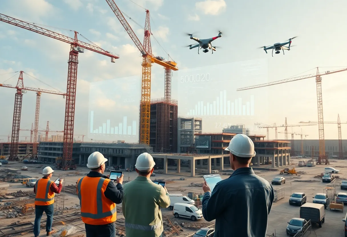
At its Waypoint summit in San Francisco, OpenSpace introduced a Visual Intelligence Platform combining smartphone-first field capture with milestone-based analytics. The suite includes OpenSpace Field, which uses Spatial AI to pin photos to floorplans and align imagery to BIM, and OpenSpace Progress Tracking, a milestone-driven service powered by an analytics partner that converts images into billing, schedule-risk and coordination insights. The platform supports 360° cameras, drones, and laser scanners and integrates with Procore, Autodesk Construction Cloud and major scheduling tools. Beta users report large time savings on field tasks, and the offering scales across tens of thousands of projects worldwide.
OpenSpace Unveils Visual Intelligence Platform at Waypoint Summit
In a move described as a new system of work for construction, OpenSpace introduced its Visual Intelligence Platform during the Waypoint customer summit. The platform comprises two new components, OpenSpace Field and OpenSpace Progress Tracking, and is powered by Disperse. The aim is to turn on‑site reality data into real‑time intelligence that can guide daily field actions and executive decisions, replacing reliance on separate financial or project‑management tools for true site visibility.
The overarching idea is to bridge the gap between what happens on the ground and what managers see in reports. ERP systems and traditional project tools handle money and processes, but the new platform is pitched as a way to capture field data in real time and convert it into actionable insights. The result, according to OpenSpace, is faster, clearer decisions that help teams spot issues earlier and reduce costly surprises.
OpenSpace Field — a field‑first system of work powered by Spatial AI
OpenSpace describes OpenSpace Field as a field‑first system of work that works with just a smartphone. Teams can capture, track, and manage site data, and the platform automatically pins every image to the correct location in floorplans while aligning images to BIM models. It also integrates with industry tools such as Procore and Autodesk Construction Cloud.
In beta trials, users reported notable time savings on common field tasks like punch lists and logging issues—an indicator of how spacing, tagging, and BIM alignment can speed up field workflows. A Suffolk product manager highlighted the ease of use and how AI features let crews take a photo, describe what is seen, and trigger work in the project management system, keeping stakeholders aligned and the project moving forward.
OpenSpace Progress Tracking — milestone‑based progress insights
The other new component, OpenSpace Progress Tracking, is described as a comprehensive, flexible, and reliable way to turn reality data into high‑level insights. It focuses on validating work‑in‑place for billing, identifying schedule risks early by comparing actual progress to planned milestones, and delivering trusted progress summaries to stakeholders.
This feature is designed to work with schedules from popular planning tools, including Primavera P6, Asta, Microsoft Project, and Excel. It is offered as an add‑on to OpenSpace Capture subscriptions, with pricing based on the scope of tracking and the number of projects involved.
Disperse and the analytics backbone
The June launch notes that Disperse supplies milestone‑based progress tracking analytics, combining jobsite imagery with human verification to provide an objective view of what has been built and what hasn’t. The combination with OpenSpace’s AI‑powered reality capture is described as an evolution that offers highly accurate, scalable progress tracking without extra work from the project team.
Company leaders have framed the collaboration as moving reality data from a documentation tool toward a strategic asset that helps solve problems earlier and keeps projects moving. The overall goal is to bring clarity from the field to the office and, eventually, to the executive suite.
Scale, scope, and real‑world impact
The two releases together paint a picture of growing adoption. By June, imagery had been captured on nearly 70,000 construction projects across 99 countries, documenting over 47 billion square feet. By September, the figures had risen to more than 75,000 projects in 124 countries, representing over 52 billion square feet.
OpenSpace notes a roster of customers relying on its platform, including Suffolk, Comfort Systems, and Tishman Speyer, among others. The platform is presented as a way to smooth the interface between site work and office workflows, offering real‑time intelligence aimed at reducing delays and guiding faster decisions.
Availability and next steps
The OpenSpace Visual Intelligence Platform is positioned as an evolution from earlier reality capture tools—OpenSpace Capture, OpenSpace BIM+, and OpenSpace Air—to a broader, image‑first workflow that supports both field and office teams. The September release indicates that the two new products, OpenSpace Field and OpenSpace Progress Tracking, are part of this platform and that more information and demos are available through the OpenSpace site.
FAQ
What is the Visual Intelligence Platform?
The Visual Intelligence Platform is a two‑part system designed to convert on‑site reality data into actionable information for field workflows and business decisions, bridging field activities with office processes.
What are OpenSpace Field and OpenSpace Progress Tracking?
OpenSpace Field is a field‑focused workflow tool that uses a smartphone to capture site data, automatically pins images to floorplans, and aligns visuals with BIM models, with integrations to key construction platforms. OpenSpace Progress Tracking provides milestone‑based insights to validate work‑in‑place for billing, detect schedule risks early, and generate citable progress summaries for stakeholders; it integrates with major scheduling and planning tools.
How does Disperse fit in?
Disperse supplies analytics for milestone‑based progress tracking, combining imagery with human verification to deliver objective progress views and support scalable project tracking.
What benefits are claimed by early users?
Early users report time savings on field tasks and earlier visibility into productivity issues and cost risks, enabling teams to address problems before they escalate.
Where can I learn more?
Visit the OpenSpace website for details on the Visual Intelligence Platform and the Progress Tracking add‑on, as well as available demonstrations.
Key features at a glance
| Feature | What it does | Related tool or integration |
|---|---|---|
| Image capture from the field | Smartphone‑based data capture that feeds into floorplan pins and BIM alignment | Procore, Autodesk Construction Cloud |
| Image‑first field workflows | Transforms field data into real‑time intelligence for daily actions | OpenSpace Field |
| Milestone‑based progress tracking | Validates work‑in‑place for billing and flags schedule risks early | Primavera P6, Asta, Microsoft Project, Excel |
| Human‑verified analytics | Combines imagery with human checks for a trusted view of progress | Disperse |
| Platform scope | Part of the Visual Intelligence Platform with field and progress components | OpenSpace Capture, OpenSpace BIM+, OpenSpace Air |
Deeper Dive: News & Info About This Topic
Additional Resources
- Morningstar / PR Newswire: OpenSpace debuts Visual Intelligence Platform
- Wikipedia: Construction management
- PR Newswire: OpenSpace launches comprehensive progress tracking solution
- Google Search: OpenSpace Progress Tracking
- TheSaaSNews: OpenSpace raises an additional $9 million in Series D
- Google Scholar: construction progress tracking imagery analytics
- San Francisco Examiner: Treasure Island park and open space projects move ahead
- Encyclopedia Britannica: Treasure Island (San Francisco)
- San Francisco Chronicle: How COVID changed public spaces
- Wikipedia: Public space